gpsworld.com
Positivewww.gpsworld.com ·
UK Scientists Unite to Map Southwest Coast Seabed
Forests Rivers OceansCoastal And Marine EcosystemsPolitics General1Maritime
Topic context
This topic has been covered 430440 times in the last 30 days across our monitored publishers.
The full article is on the original publisher site. This page only shows the headline and a very short excerpt.
AI insight
AI-generatedThe survey collects seabed data that can inform offshore wind farm siting, cable routing, and defense sonar mapping. No immediate commercial price or supply impact; the mechanism is long-term data provision for energy and defense planning. Weak commercial mechanism; no direct revenue or cost channel identified.
Signals our AI researcher identified
Extracted by our AI model from this article and related public sources — not direct quotes from the publisher.
- Seabed mapping survey CSM2026 along UK southwest coast from April 20 to May 19.
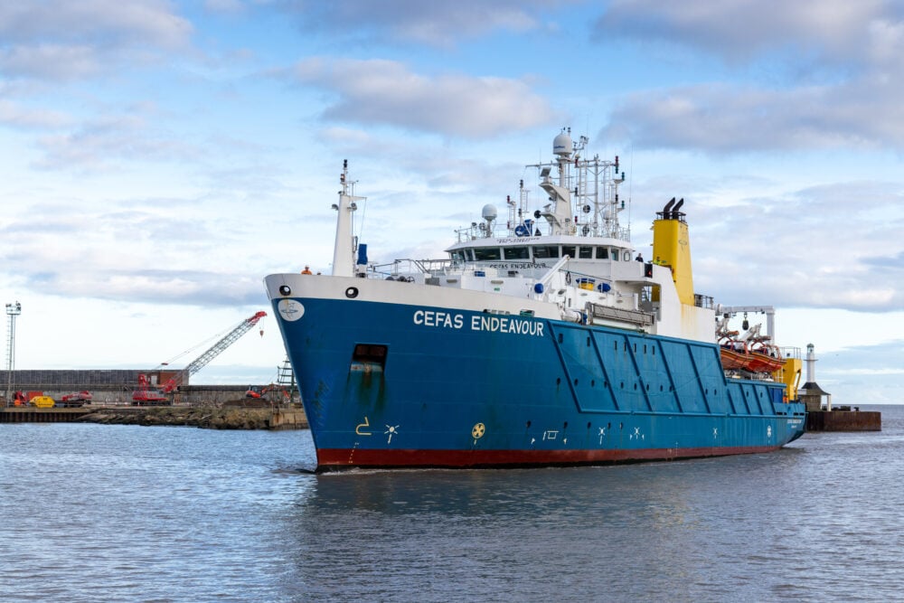
- 26 scientists aboard RV Cefas Endeavour, starting in Lowestoft and ending in Falmouth.
- Collaboration with over 30 public sector organizations including Maritime and Coastguard Agency and UK Hydrographic Office.
- Data collection for hydrographic, geological, and environmental purposes.
- Supports offshore energy, marine ecosystem science, and defense applications.
Related stories
finance.yahoo.com
Transcript Valneva Q1 2026 Earnings

fool.com
Keysight Keys Q2 2026 Earnings Transcript

zerohedge.com
Europe Primed Lower Open Nvidia Lower Post Earnings and Crude Rebounding Modestly After

cnbc.com
Lululemon Proxy War With Chip Wilson Goes Public Sets Annual Meeting
finance.yahoo.com